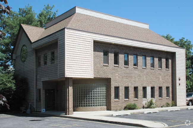
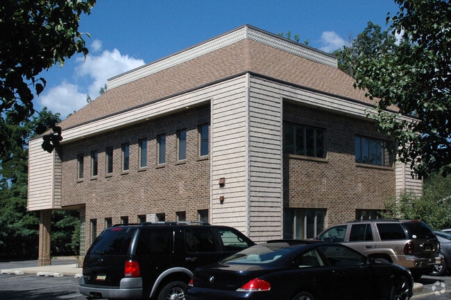
Property Record
120 Drum Point Rd, Brick, NJ 08723
NEARBY LISTINGS FOR SALE OR LEASE
Property Detail
120 Drum Point Rd
New York-Jersey City-White Plains, NY-NJ
Bramblewood Estates Sec 02
07-00548-07-00001
.4091AC
Commercialnec
Ocean
X
New Jersey
34029C0192F
1
2024
0.41 AC
2025
Ocean County
713900
Northern New Jersey
3,398 SF
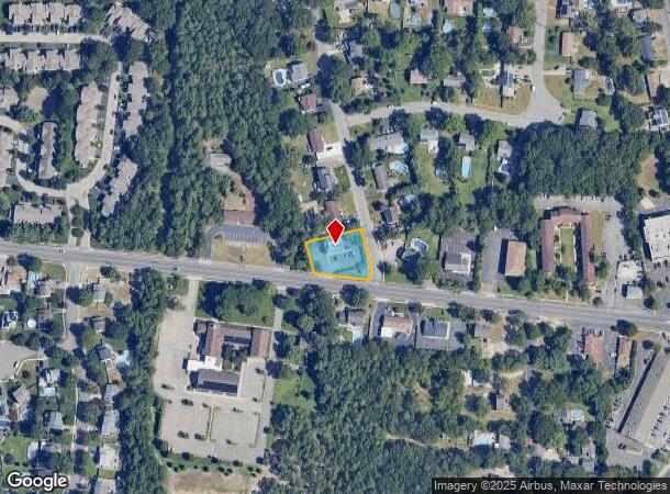
DEMOGRAPHICS near 120 Drum Point Rd
1 Mile
3 Mile
5 Mile
2024 Total Population
10,430
66,973
186,279
2029 Population
11,063
71,208
197,255
Pop Growth 2024-2029
+ 6.07%
+ 6.32%
+ 5.89%
Average Age
38
45
39
2024 Total Households
3,752
27,991
66,144
HH Growth 2024-2029
+ 5.54%
+ 5.59%
+ 5.66%
Median Household Inc
$102,060
$78,200
$82,976
Avg Household Size
2.60
2.30
2.60
2024 Avg HH Vehicles
2.00
2.00
2.00
Median Home Value
$342,297
$323,222
$359,995
Median Year Built
1972
1975
1977
Nearby Places
Map Layers
Map Styles
 Street
 Aerial
- Restaurants
- Banks
- Shops
- Fitness
- Groceries
PUBLIC TRANSPORTATION
COMMUTER RAIL
Bay Head (North Jersey Coast Line - NJ Transit Commuter Rail (NJ Transit))
DRIVE
WALK
Distance
Bay Head (North Jersey Coast Line - NJ Transit Commuter Rail (NJ Transit))
13 min
7.7 mi
Point Pleasant Beach (North Jersey Coast Line - NJ Transit Commuter Rail (NJ Transit))
DRIVE
WALK
Distance
Point Pleasant Beach (North Jersey Coast Line - NJ Transit Commuter Rail (NJ Transit))
14 min
7.8 mi
Freight Ports
New York Container Terminal
DRIVE
WALK
Distance
New York Container Terminal
70 min
54.4 mi
Nearby Properties
Address
Land Use
TOTAL SIZE
Lot Size
Zoning
Address
Land Use
TOTAL SIZE
Lot Size
Zoning
45.53 AC
B3
Address
Land Use
TOTAL SIZE
Lot Size
Zoning
7,936 SF
25.60 AC
EM18
Address
Land Use
TOTAL SIZE
Lot Size
Zoning
22.88 AC
HS
Address
Land Use
TOTAL SIZE
Lot Size
Zoning
117 AC
RR1
Address
Land Use
TOTAL SIZE
Lot Size
Zoning
29.34 AC
B4
Address
Land Use
TOTAL SIZE
Lot Size
Zoning
23,843 SF
37.83 AC
B5
Address
Land Use
TOTAL SIZE
Lot Size
Zoning
25.22 AC
B3
Address
Land Use
TOTAL SIZE
Lot Size
Zoning
1.80 AC
B5
Address
Land Use
TOTAL SIZE
Lot Size
Zoning
22.34 AC
ABC
Address
Land Use
TOTAL SIZE
Lot Size
Zoning
26.37 AC
R75
Address
Land Use
TOTAL SIZE
Lot Size
Zoning
30 AC
RR1
Address
Land Use
TOTAL SIZE
Lot Size
Zoning
39.84 AC
OPT
Address
Land Use
TOTAL SIZE
Lot Size
Zoning
39,777 SF
3.50 AC
M1
Address
Land Use
TOTAL SIZE
Lot Size
Zoning
26.43 AC
B3
Address
Land Use
TOTAL SIZE
Lot Size
Zoning
52.07 AC
RR2
Address
Land Use
TOTAL SIZE
Lot Size
Zoning
5,290 SF
12.95 AC
LP
Address
Land Use
TOTAL SIZE
Lot Size
Zoning
152.17 AC
ABC
Address
Land Use
TOTAL SIZE
Lot Size
Zoning
15.31 AC
B3
Address
Land Use
TOTAL SIZE
Lot Size
Zoning
19.40 AC
B3
Address
Land Use
TOTAL SIZE
Lot Size
Zoning
11.83 AC
B3
Address
Land Use
TOTAL SIZE
Lot Size
Zoning
274,160 SF
42.09 AC
ABC
Address
Land Use
TOTAL SIZE
Lot Size
Zoning
9,429 SF
9.12 AC
B3
Address
Land Use
TOTAL SIZE
Lot Size
Zoning
47.75 AC
RR2
Address
Land Use
TOTAL SIZE
Lot Size
Zoning
14.38 AC
B3
Address
Land Use
TOTAL SIZE
Lot Size
Zoning
75,308 SF
3 AC
M1
Address
Land Use
TOTAL SIZE
Lot Size
Zoning
32.50 AC
RM
Address
Land Use
TOTAL SIZE
Lot Size
Zoning
32.80 AC
RM
Address
Land Use
TOTAL SIZE
Lot Size
Zoning
18.39 AC
B3
Address
Land Use
TOTAL SIZE
Lot Size
Zoning
194,670 SF
22 AC
M1
Address
Land Use
TOTAL SIZE
Lot Size
Zoning
15.32 AC
ABC
The World's #1 Commercial Real Estate Marketplace
Connect with us
© 2025 CoStar Group
The information above has been obtained from sources believed reliable. While we do not doubt its accuracy we have not verified it and make no guarantee, warranty or representation about it. It is your responsibility to independently confirm its accuracy and completeness. Any projections, opinions, assumptions, or estimates used are for example only and do not represent the current or future performance of the property. The value of this transaction to you depends on tax and other factors which should be evaluated by your tax, financial, and legal advisors. You and your advisors should conduct a careful, independent investigation of the property to determine to your satisfaction the suitability of the property for your needs.